

What became apparent when researching the history of mills, weirs, canals and navigation of the River Lugg is that one use of the river often created structures which hampered other uses of it and also affected the possibilities of fish travelling up the river to spawn. There have been more recent assessments of the instream barriers such as weirs, culverts and dams which have been identified as a significant pressure to physical river habitat – see Atkins report of the need for a multidisciplinary approach (Janet Shaw and colleagues). Below is some history of mills and weirs on the Lugg with references at the end.
Information about the River Lugg: Source: Pool Hill, near Llangynllo. Height at source 1,631 ft, 63 miles long. Joins the Wye at Mordiford. Height at end 151 ft.

Domesday Book
At the time of the Domesday Book (1086) the Lugg was an important river for milling. Some 80 mills were recorded in the county of Herefordshire, and of those, around one third were located in the valley of the Lugg, some on tributaries and others on the main river.

In addition, those on the Lugg were valued considerably higher than those elsewhere, with an average value of 15 shillings and 4 pence, compared to 6 shillings and 7 pence for mills on other rivers.

At that time, the hay meadows on the banks of the Lugg were the largest in the county, and the valley produced large crops of hay and corn. At least four of the sites were recorded as having fulling mills subsequently, but none were recorded when a survey of the river was made in 1697.
Mills in Leominster
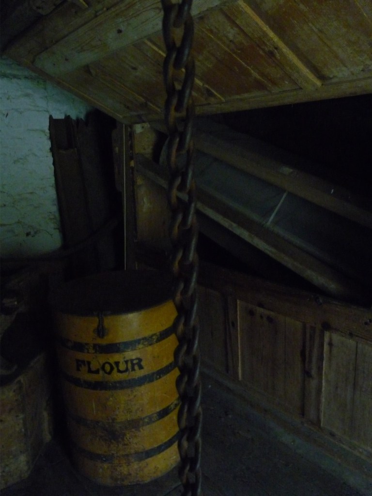
Leominster had at least nine mills, powered by various river channels, with guilds controlling industries that ranged from weaving and wool-stapling to malting, tanning and glove-making. There were also agricultural ironworks, oil and corn mills, brickfields and an ink mill which later converted to grinding coal for foundry blacking.

Uneasy relationships
On many of Britain’s lowland rivers, there was an uneasy relationship between use of the water for milling, which required weirs to be built, and navigation, which required freedom of movement along the waterway.
Four Acts of Parliament
Between the 17th and 19th centuries, four Acts of Parliament were passed which specifically named the River Lugg in their titles, but the middle two had the most effect on the river.
Idea to build weirs and locks
The first Act was passed on 19 May 1662, entitled:
An Act for the making navigable the Rivers Wye and Lugg, and the Rivers and Brooks running into the same, in the counties of Hereford, Gloucester and Monmouth.
Sir William Sandys was appointed to carry out the work, which involved building weirs and flash locks to maintain water levels, but his previous experience on the Warwickshire Avon did not fit the Wye, which was a much steeper and faster-flowing river, and the work was abandoned by about 1668, before any work had been started on the Lugg.
Survey of Mills on the Lugg before 1695 Act
On the Wye, some of the weirs were associated with fishing, but on the Lugg, all of them were connected with milling. Details of them have survived, because a comprehensive survey was carried out by an anonymous author, thought to be Daniel Dennell, who had previously worked on the Exeter Canal, and Dennell’s document was acquired by the British Museum in 1856. The survey listed ten mills between Lugg Bridge, Leominster and the junction with the Wye, but this was probably the number of wheels or pairs of millstones, rather than the number of buildings where milling occurred. The annual value of each mill was to be established, and the price to buy the mill and weir was then fixed at 16 times that value.

1965 The second Act of Parliament was obtained on 17 March 1695, entitled:
An Act for making navigable the Rivers of Wye and Lugg, in the county of Hereford.

One important effect of this act was that it re-established both rivers as free navigations, for it contained the clause:
Therefore be it enacted that the rivers Wye and Lugg may be henceforth accounted, deemed and taken to be free and common rivers for all to make use of for carrying and conveying of all passenger goods, wares and commodities by boats, barges, lighters and other vessels whatsoever.

Work carried out
After the Act was passed, it is not clear exactly what work was done, since the relevant sheets from the accounts are missing, but a lot of money was spent. Locks may have been put into some of the weirs; this was certainly true at Tidnor, and may have also been the case at the confluence with the Wye, at Mordiford, Hampton Court, and some other sites. Several bridges were altered, by breaking one of the arches and constructing a timber drawbridge or later a raised arch. There are a few mills left, and some obvious mill sites, but many of the mills below Leominster were bought up and their weirs demolished as part of a 1690’s scheme to make the river navigable. This was not a success, as the water levels dropped creating shoals, and in the 1720s, some of the weirs were reinstated, with pound locks to enable boats to bypass them.

Destroying weirs a mistake
A third Act of Parliament was obtained on 15 May 1727, which openly stated that destroying the weirs had been a mistake, and allowed the trustees to reinstate them, with associated locks. Neither the minutes nor the accounts for this phase of the work have survived.
Thomas Chinn, a millwright from Tewkesbury, was employed to build locks around 1748, after money was raised by subscriptions in Leominster. He was later indicted for building locks against four bridges, but this charge may have been malicious. When the case was heard, he was only fined sixpence for each bridge and was not required to remove the locks.
There are known to have been locks at twelve sites between Leominster and the Wye, at Volca Meadow, Ford Bridge, Hampton Court, Bodenham Mill, Kings Mill, Moreton Bridge, Wergins Bridge, Sherwick Mill, Lugg Bridge, Tidnor, Mordiford and the confluence. Some of these may have been half locks or flash locks, but some were definitely pound locks with two sets of gates, and of the three locks still in existence in 1906, both Tidnor and Mordiford were pound locks, but no clear evidence for a second set of gates at Lugg Bridge has been found. Barges on the river were hauled by teams of men.

Wye and Lugg Towing Path Company
A fourth Act of Parliament was obtained in 1809, to allow horse towing paths to be constructed on the Wye and the Lugg, but there is no evidence that such a path was ever started on the Lugg. Navigation by boat up to Leominster was for a time possible, although it was never hugely successful. Some traffic may have used the lower 5 miles (8 km) of the Lugg up to Lugg Bridge until about 1860, when railways had been built in the area.

Free navigation
As a result of the 1695 Act, the Lugg was a free navigation, but in 1995 the National Rivers Authority sought to apply bylaws to both the Wye and the Lugg. Their case was taken to the High Court, and was continued by the Environment Agency, which superseded the National Rivers Authority later that year. This action eventually led to the granting of the Wye Navigation Order in 2002, which:
reaffirmed the right of navigation on both rivers, appointed the Environment Agency as the navigation authority for the rivers, but prohibited the construction of weirs and locks.
Most use of the river is now by canoes and kayaks, although it is still sometimes used by small boats but can be very dangerous when in flood. In February 2020, it was one of several rivers with severe flood warnings following the impact of Storm Dennis.

The river is also used for fishing, as it has good populations of wild brown trout and grayling. Water quality of the river system is moderate, although some of its tributaries have poor water quality, and some bad. In common with many rivers, the chemical quality changed from good to fail in 2019, following the introduction of testing for chemicals not previously included in the quality assessment. The whole of the river is a Site of Special Scientific Interest, and since 2003, a policy of building fish passes where there are weirs has led to significant improvements to the presence of migratory fish in the river.
Mills and Weirs as you travel downstream
• Old Mill, Presteigne (formerly known as new Mill House) and close by a weir which once powered the mill
• Near Lyepole Bridge, As the river turns to the south-east, a large weir directs water into a mill leat, which runs on the north side of the main channel to Aymestrey Mill, a grist mill built in the 1860s. Most of the machinery is still in situ, and the wheel now powers a printing press.The A4110 road bridge crosses the river and the mill tailrace, and as the river turns to the south, a similar weir creates a leat to the west of the river.
• Mortimer Cross Water Mill fed by another weir. It is 89 feet (27 m) long and a 220-yard (200 m) leat feeds the mill, which has three sets of stones. It was a paper mill until the 1830s, and then became a grain mill. New machinery was installed in 1870 and it produced animal feed until the 1940s. It is unusual in that it was designed to be operated by one man.
• At Lugg Green, Kingsland is another Lugg Bridge, and after a series of weirs, the river arrives on the northern edge of Leominster.
• A leat to Crowards Mill, now disconnected from the main river, was formerly the main channel of the Lugg, with much of the flow passing over a weir into the Kenwater. Crowards Mill was still used for pumping water until 1974. Most of the mills in Leominster had gone by the time of the 2nd WW, and one of the last surviving sites is now a sports centre in Bridge Street
• Osbourne Mill
• Marsh Mill
• A third corn mill in Leominster
• Pinsley Brook ran through the town just to the south of Kenwater, to power Pinsley Mill, another corn mill just to the north of Leominster Railway station and joined the Lugg below Eaton Bridge. Pinsley Mill was hit by a mysterious fire in 1754, perhaps sealing the towns fate as a backwater of the Industrial Revoultuion. In 1748 cotton magnate Daniel Bourn has invested heavily in upgrading Pinsley Mill as one of only four early cotton spinning complexes, complete with his own patented carding engine. When it burnt down, Leominster never recovered form its early lead in the textiles industry.
Bridges of Leominster
There were once 19 bridges in Leominster, most of them crossing the Lugg, Kenwater or Pinsley Brook.The river system within the town was radically reworked in the 1960s, as part of a flood alleviation scheme. The Lugg continued southwards along the course of the Kenwater, to a new weir close to the former course of the Railway. The Kenwater passed over the weir, while a new channel was cut for the Lugg, following the course of the railway.
• Lugg Bridge at Lugwardine dates from the 14th century, and was repaired in 1409 and 1464. It has three arches, and was widened in the 1960s, when the south side was largely rebuilt. The Little Lugg joins from the east near the bridge, which was the location of corn mills in 1903, when a structure spanned the river to the south of the bridge.
‘Water Poet’ John Taylor
As interest in river navigation increased, shipment of goods along many rivers remained difficult due to the number of weirs. The most vivid description of these obstructions was provided by the ‘Water Poet’ John Taylor. A Gloucester-born, self-educated, eccentric Thames wherryman, Taylor wrote and published numerous pamphlets and verses describing his travels by river, road and sea through Britain between 1618 and 1653. He also wrote about fashion, linen and needlework.
Heather Hurley writes of the difficulties of river navigation and talks about John Taylor whose poetry Robert Crompton later read for us including his poem The Arrant thief (1622) becrying the introduction of horse drawn carriages taking trade away from the Thames wherrymen.
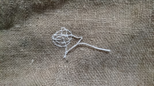
Taylor also wrote The Prayse of the Needle (1631) – 144 lines, an introduction to a book about sewing and includind some stitiching sonnets – which Robert Crompton also later read to the stitchers and inspired Maggie to write two of her own stitiching sonnets.
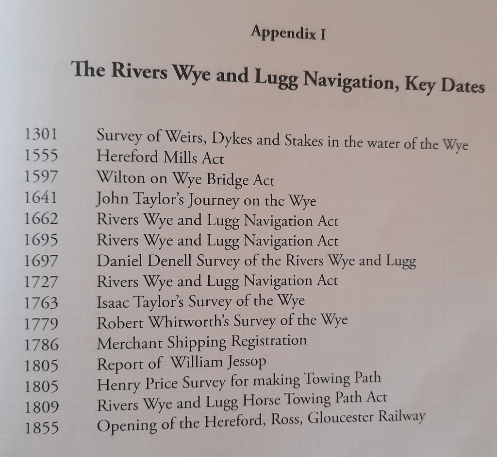
Heather Hurley very usefully supplies a list of Key Dates for Navigation of the rivers and her book gives more detail about these events.
References Used:
I found other documents that detailed the histories of the mills on the Lugg for example, Gordon Tucker’s ‘The Mills of the Lugg Valley in Radnorshire‘ or Alan Stoyel’s ‘Pilot study of the mills and associated water arrangements within the catchment area of the River Lugg‘ (January 2015).
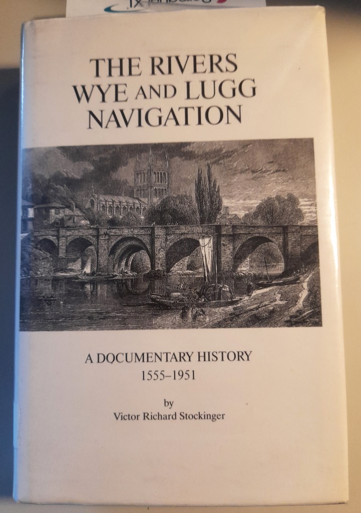
I was loaned two useful books by snowdrop stitcher and artist Kate Green. The first is The Rivers Wye and Lugg Navigation – a documentary history 1555- 1951 by Victor Richard Stockinger. Another stitcher (and lifelong canoeist on the River Lugg) was inspired by it and found a copy for her husband’s birthday, which she reported back that he loved.
Kate also loaned another wonderful book ‘Herefordshire’s River Trade – craft and cargo on the Wye and Lugg‘ by Heather Hurley.

And a final loan from Kate: The Lugg Valley, Herefordshire – archaeology, landscape change and conservation by Peter Dorling (2007). I just dipped into this.

The future of water power on the Lugg
More recently (2006) there have been suggestions of using mini hydroelectric power plants along the River Lugg as an alternative to large-scale windfarms in the county.
Around 100 waterwheel driven generators – camouflaged as cottages or other landscape features – have been proposed for the 52km stretch of the river between Presteigne and Mordiford. The wheels would provide electricity for riverside communities or eventually even somewhere the size of Leominster, with any surplus sent into the National Grid.
Hereford Times 20th February, 2006
There is much more to investigate in this topic of human uses of the river; a study of any or all of these features along the Lugg, that is the mills, weirs, canals, and boats would be a great future heritage project. Some of the stitchers reported the recent and ongoing excellent renovation of a mill at Mordiford and attended an open day about it.
